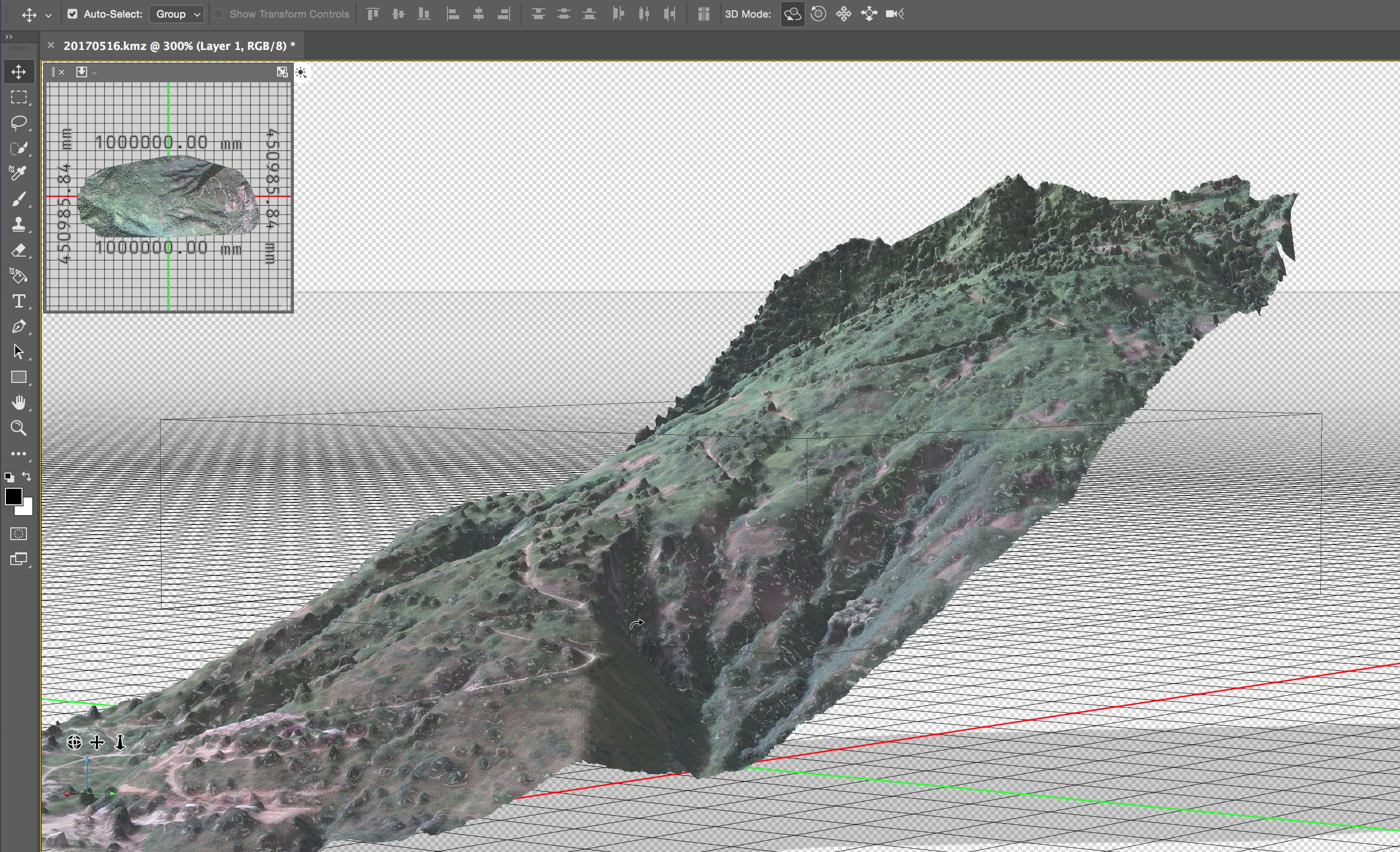
 Earlier this week I was in Sulawesi to create a detailed 3D map of an area of land soon to be developed. Google Earth provides a pretty good view of this area as you can see here, but Google Earth cannot compete with my DJI Inspire 1 drone and the [Maps Made Easy](https://www.mapsmadeeasy.com//) app.  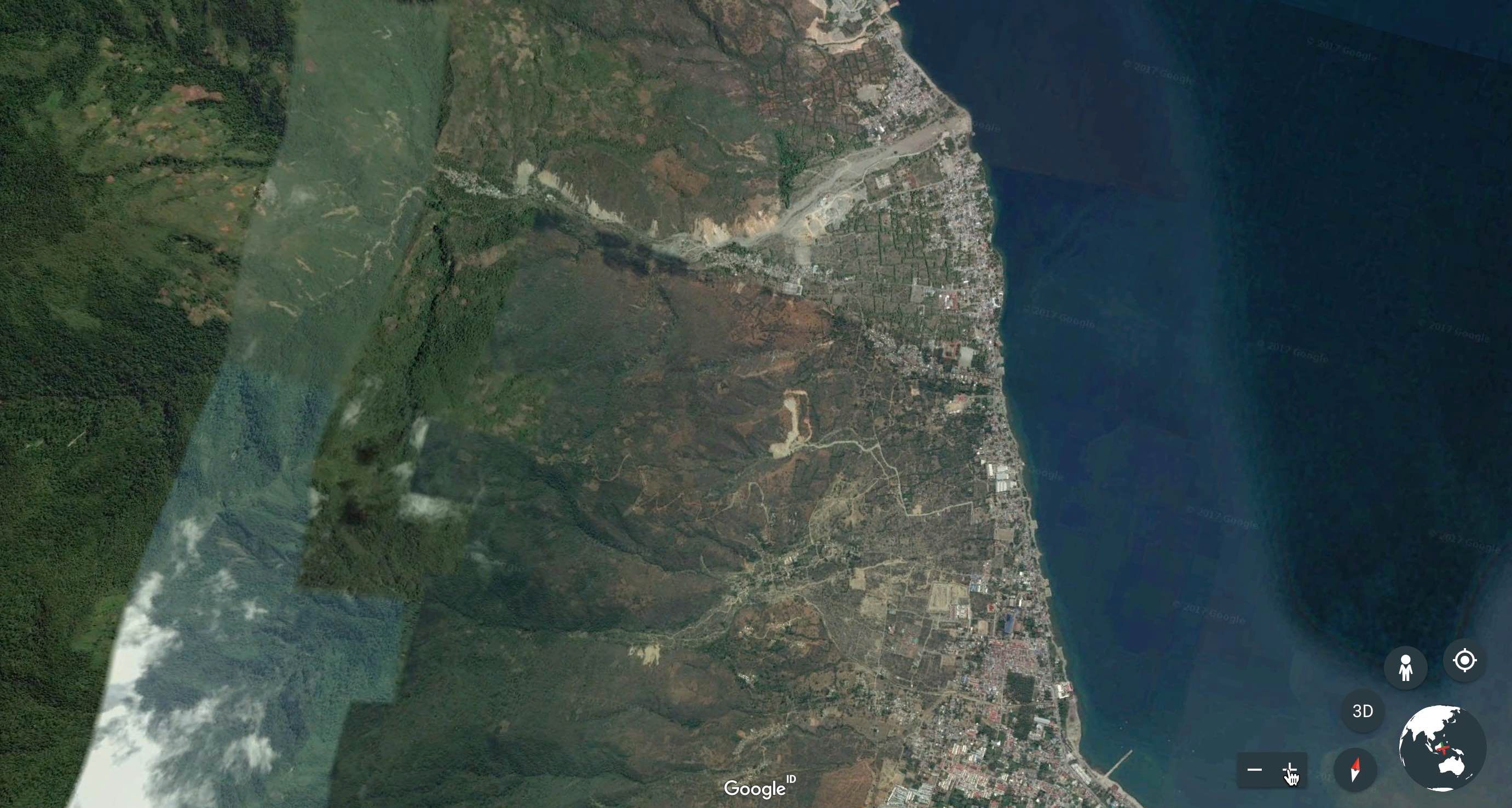 The area either side of the dirt track running up the hill was the area I needed to focus on. 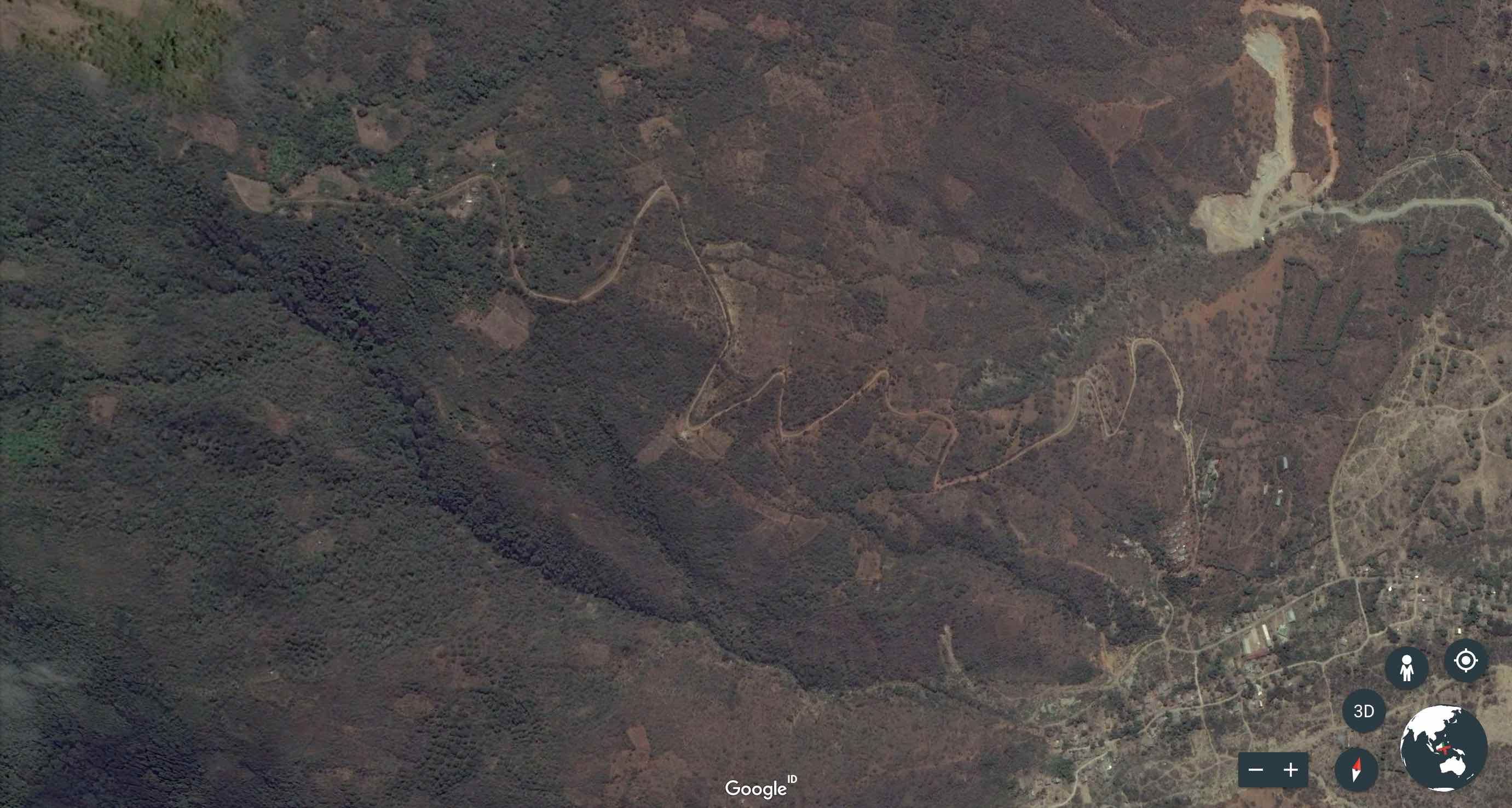 <center>All images above are from Google Earth</center> ---  <center></center> I am not going to tell you that it was easy, because it wasn't! I watched many tutorials over the course of two nights to fully understand how to use this £10 Maps Made Easy app I had downloaded onto my ipad. Once I figured out the exact area which needed to be captured in detail I was able to create a flight path and calculate how many batteries I would need and how many pictures would be taken. 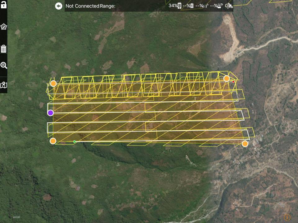 The area I was mapping required three batteries flying at a height of 200m. More batteries would be required if I was looking to achieve a higher resolution, because the drone would have to fly lower and therefore make more passes, taking more photos. ## The Flight From this point on it was actually very simple. I did have to provide an internet connection to my ipad through the hotspot feature on my iphone but after pressing start all I did was sit back and watch the drone do its thing. And this is what I saw on my computer when I got home... 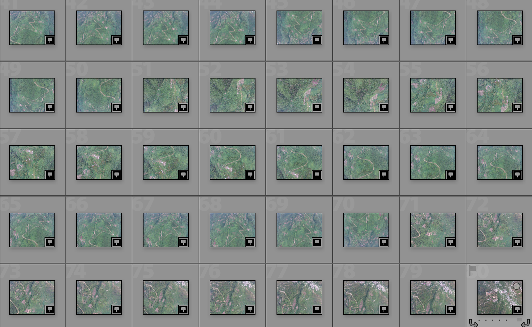 After feeding them into the Maps Made Easy website, 24h later I was sent a bunch of different files (for free!). The first of which was these... showing the exact area I had mapped. 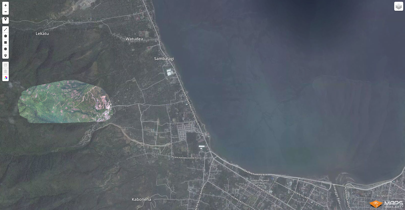 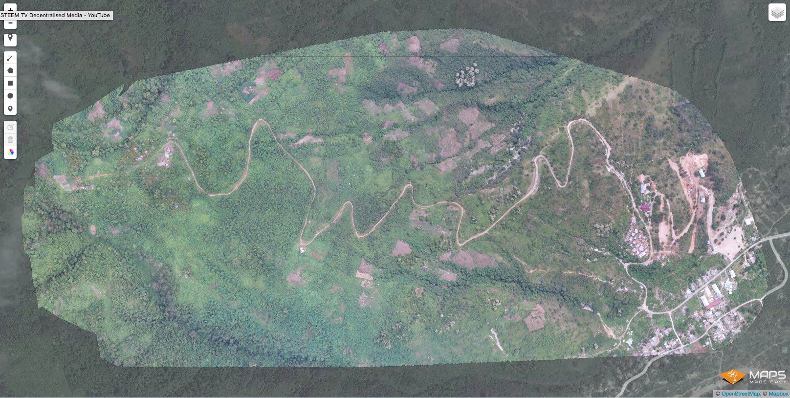 I received a high quality tif of the mapped area, giving me great detail when zoomed in. I also received a whole collection of data relating to the 3D mapping process. Here are the file types i received in my bundle: - 3D.obj - 3D.mtl - 3D.jpg - DEM.tif - .kmz - .las - .txt - COLOR.tif 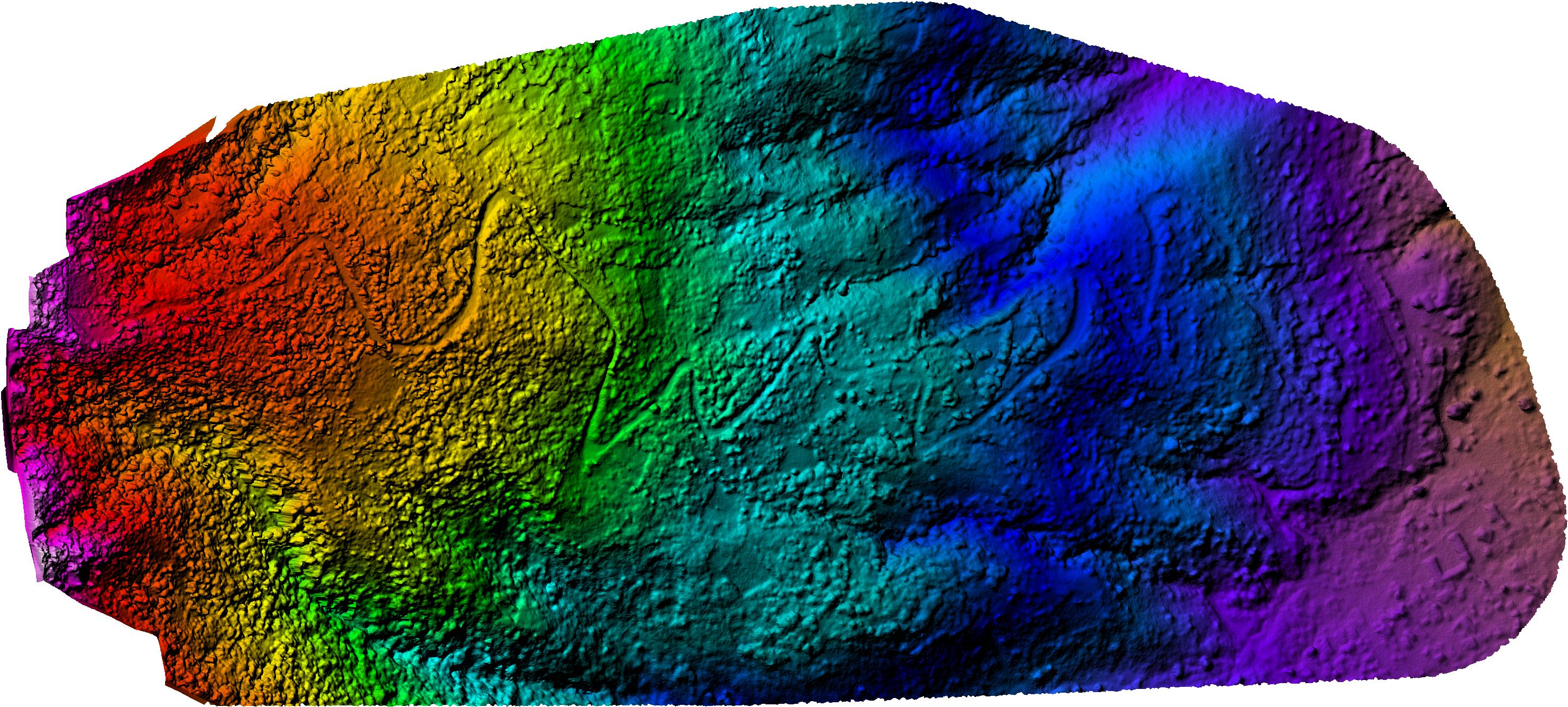 This colour map gives an indication of actual terrain formation and is needed for the next stage of the process. ## Photoshop Within photoshop I was able to open the .kmz file which connects with all the others and immediately provides me with a 3D map I can rotate and zoom into. 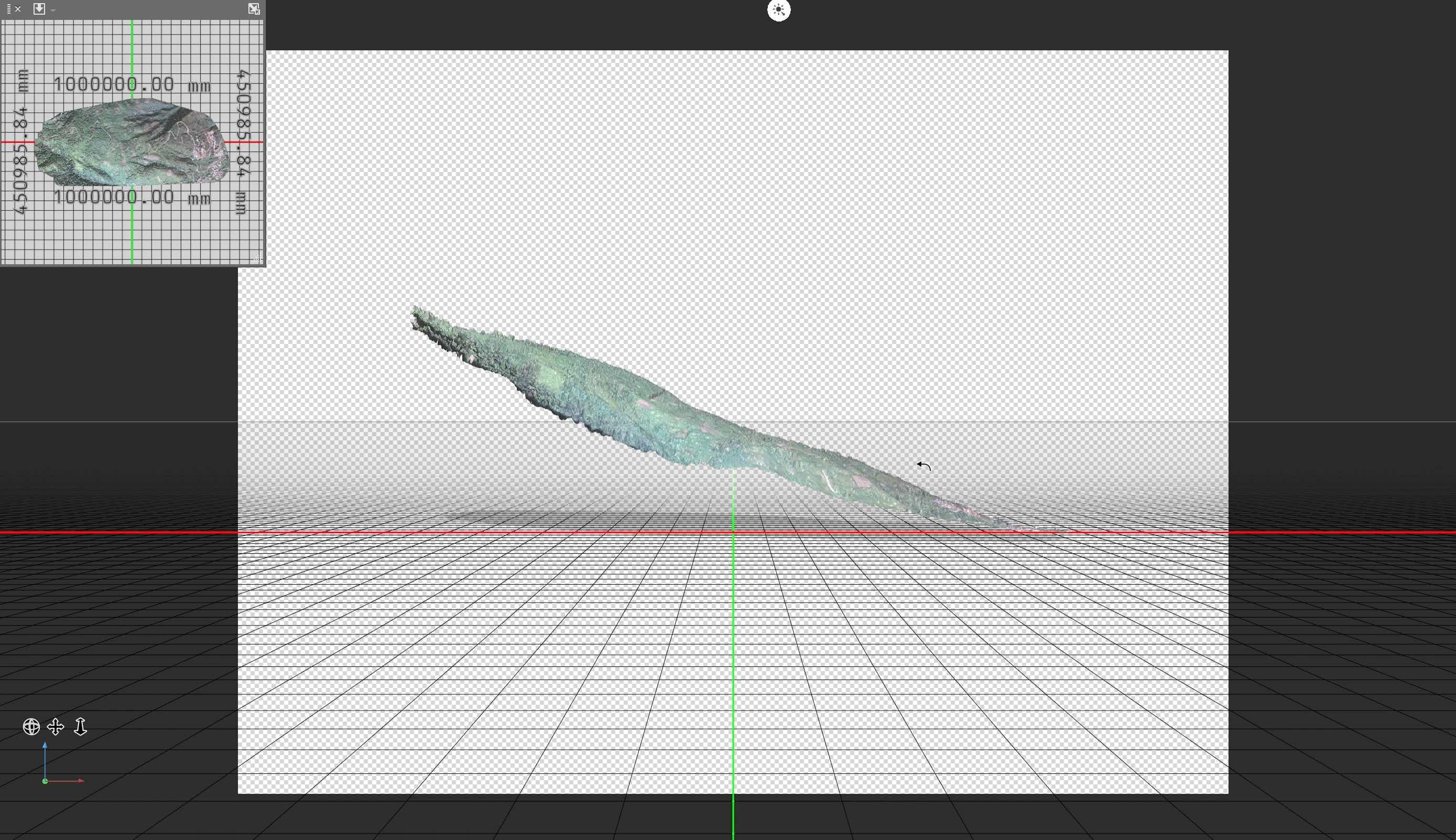 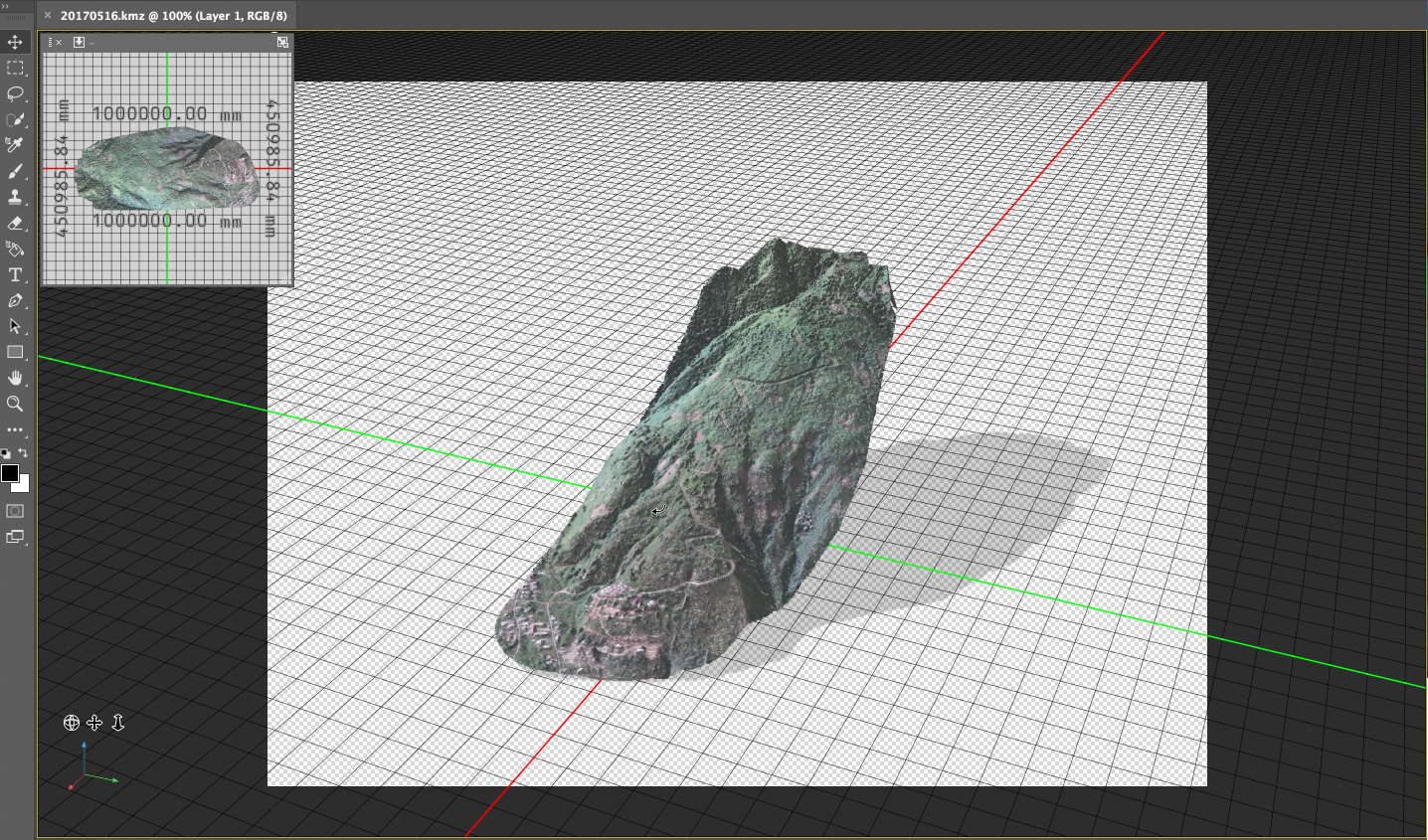 The latest version of Google Earth does actually provide a pretty amazing 3D function now, but the first thing i noticed was that the detail was not as good as my version and there were big inaccuracies too. I could see steep drops in incline on my 3D map, indicating clearly the areas where properties cannot be built, just to the right of the road, as you can see above. While using the 3D feature on Google Earth the incline did not appear so steep, giving the appearance that properties could potentially be built there. Google Earth 3D shot of location seen from one angle 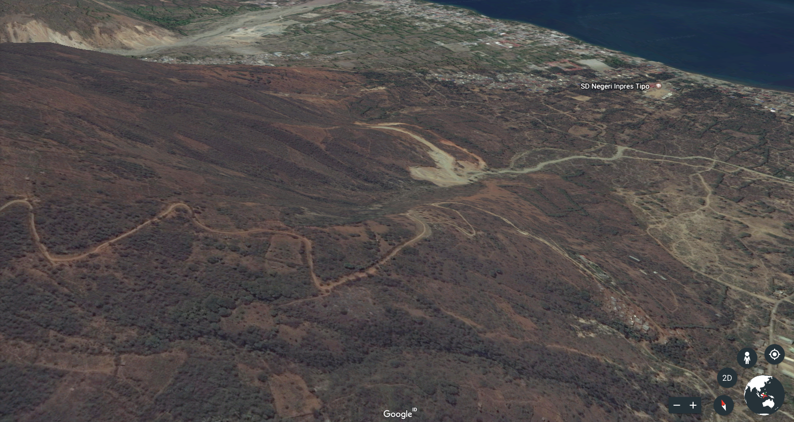 Google Earth 3D shot of location seen from another angle 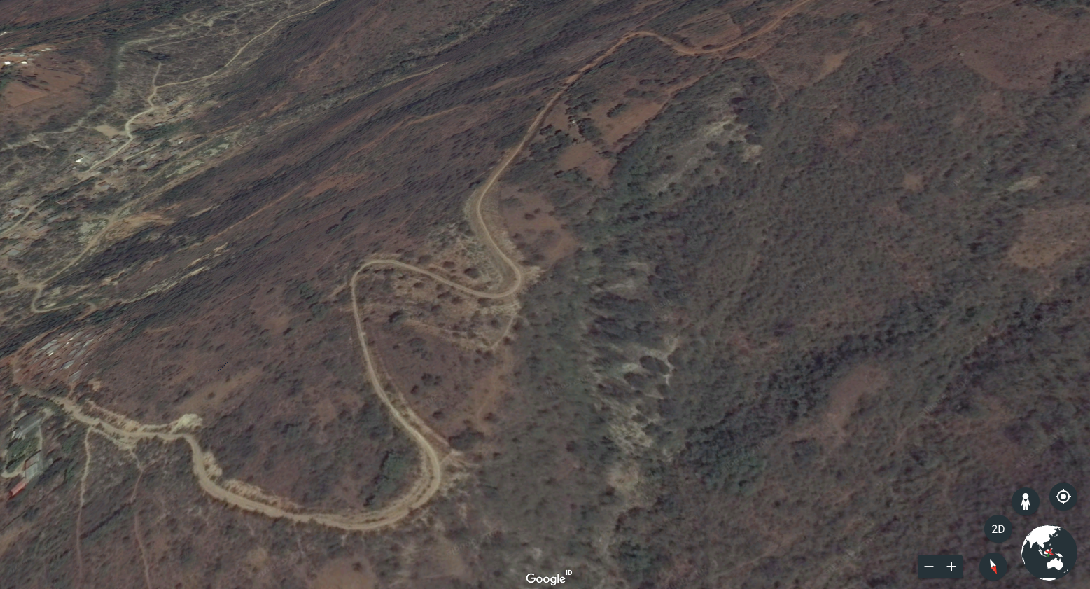 Both of these 3D Google Earth angles do not show the severe drop which is very apparent in my own 3D mapping.  I still have to create contour lines indicating 5 meter intervals... and in all honesty I don't actually know how to do this bit yet! But a few more tutorials and late nights will see me through to the finish line. Hope you enjoyed learning about this process. Here is a link to [Maps Made Easy](https://www.mapsmadeeasy.com//) .jpg)
| author | samstonehill |
|---|---|
| permlink | accurate-3d-terrain-mapping-using-a-drone-maps-made-easy |
| category | photography |
| json_metadata | {"tags":["photography","drone","technology","blog","mapping"],"image":["https://steemitimages.com/DQmddUcVbmau2cbHbZSXDFimHZC6egY2a4oWvXtGZvCGH2a/Screen%20Shot%202017-05-19%20at%2010.43.57.png","https://steemitimages.com/DQmQ1cPHsXdh2K5DTx9QUGyoWWAMJRzQgi6tstrRXjUNs3F/Palu%20wide.jpg","https://steemitimages.com/DQme5RTzZFvZLKoWv2sxqoHP4gkXDbJ5eHzy5rZyXoyNrPP/Paul%20mid.jpg","https://steemitimages.com/DQmVcFJ65ZzAaTheeijf4jCrSa2pZrcMFfnSGgPW1f97D57/Paul%20close.jpg","https://steemitimages.com/DQmdbsjxjwQhFc1pr6AEh3CqPq2245rURM9EeUmgroyVfw6/3D%20mapping.jpg","https://steemitimages.com/DQmYv6PraxbTa7g6m8JYiac5GVVENsmw6vL3oGyqpTqLs2A/Screen%20Shot%202017-05-19%20at%2018.10.46.png","https://steemitimages.com/DQmSRryg8UAikRKApaqFMo8tzwS4KrjqKyx3QeniXXQeXDf/mapping%20.jpg","https://steemitimages.com/DQmX5AEoUwDewBd4ojUbYkzprZA5R2669QZkQwpCk37vX2c/Screen%20Shot%202017-05-19%20at%2010.16.14.png","https://steemitimages.com/DQme1VA9SRpVBkfSp6KoBhHQMtgWeXB9C9X9UndZe9w7eMG/Screen%20Shot%202017-05-19%20at%2009.57.40.png","https://steemitimages.com/DQmYZ7E2cW2JgmwMktMHpKfc6ni9jfA3zZ3Bmy8i1wWCdST/area%20of%20detailed%20mapping.jpg","https://steemitimages.com/DQmRQcbhe1D18iBeXuuRyfzpLon2S6e1wuwjdjDZqnQ2TCw/20170516-COLOR.jpg","https://steemitimages.com/DQmSrrVhtbBFEMPo2XgdMJEnXfypv3dfP1tuCaMMjRAGSGP/Screen%20Shot%202017-05-19%20at%2011.16.07.jpg","https://steemitimages.com/DQmRy3SrQTqQLFtoK7Ytz1MyHwzjeTLcgta4FVtMrswDZjv/Screen%20Shot%202017-05-19%20at%2010.37.09.png","https://steemitimages.com/DQme6pMREKtsnXguZjhTFJacHKJZVzGM7aJBByhN1g1NtA5/Screen%20Shot%202017-05-19%20at%2011.10.24.png","https://steemitimages.com/DQmYYxKhW7yi4XbXzmULxBMzgWKAhjrEwy9cPpyEqqqJr7S/Screen%20Shot%202017-05-19%20at%2011.11.04.png","https://steemitimages.com/DQmb7D5QngLcEkiVp6f3SwLkxpEA13EgcbY5ko7sKqDKQg1/ASWD%20final%20banner%20v2%20(low).jpg"],"links":["https://www.mapsmadeeasy.com//"],"app":"steemit/0.1","format":"markdown"} |
| created | 2017-05-19 10:44:00 |
| last_update | 2017-05-19 21:29:48 |
| depth | 0 |
| children | 17 |
| last_payout | 2017-05-26 10:44:00 |
| cashout_time | 1969-12-31 23:59:59 |
| total_payout_value | 8.686 HBD |
| curator_payout_value | 2.436 HBD |
| pending_payout_value | 0.000 HBD |
| promoted | 0.000 HBD |
| body_length | 5,722 |
| author_reputation | 560,492,852,542,708 |
| root_title | "Accurate 3D terrain mapping using a DJI drone & Maps Made Easy" |
| beneficiaries | [] |
| max_accepted_payout | 1,000,000.000 HBD |
| percent_hbd | 0 |
| post_id | 3,558,588 |
| net_rshares | 3,537,543,061,617 |
| author_curate_reward | "" |
| voter | weight | wgt% | rshares | pct | time |
|---|---|---|---|---|---|
| pharesim | 0 | 502,032,788,495 | 5% | ||
| piranhax | 0 | 9,487,469,961 | 100% | ||
| rok-sivante | 0 | 914,909,113,930 | 100% | ||
| mammasitta | 0 | 12,421,631,212 | 50% | ||
| chhaylin | 0 | 118,023,797,894 | 100% | ||
| nepalipahad | 0 | 27,084,360,486 | 100% | ||
| speda | 0 | 72,826,091,543 | 100% | ||
| juvyjabian | 0 | 686,115,118 | 10% | ||
| happyphoenix | 0 | 2,121,131,697 | 30% | ||
| ace108 | 0 | 268,088,624,643 | 100% | ||
| yoganarchista | 0 | 5,098,947,036 | 100% | ||
| rznag | 0 | 33,795,966,785 | 100% | ||
| bullionstackers | 0 | 36,213,205,443 | 74% | ||
| williambanks | 0 | 23,594,900,786 | 100% | ||
| sykochica | 0 | 63,585,760,098 | 100% | ||
| themagus | 0 | 45,030,120,062 | 100% | ||
| boddhisattva | 0 | 24,347,228,298 | 100% | ||
| neptun | 0 | 4,030,635,688 | 100% | ||
| samstonehill | 0 | 61,196,082,381 | 100% | ||
| kenistyles | 0 | 19,002,264,853 | 100% | ||
| iwantri1976 | 0 | 66,895,170 | 50% | ||
| sature | 0 | 1,992,828,136 | 100% | ||
| leesmoketree | 0 | 31,732,444,610 | 86% | ||
| englishtchrivy | 0 | 25,287,467,298 | 30% | ||
| jlufer | 0 | 12,816,682,810 | 100% | ||
| annaarthur | 0 | 10,686,563,246 | 100% | ||
| profitgenerator | 0 | 31,743,164,459 | 100% | ||
| inphiknit | 0 | 11,765,013,731 | 61% | ||
| imerick | 0 | 1,206,019,148 | 100% | ||
| rynow | 0 | 18,851,609,967 | 100% | ||
| jennswall | 0 | 614,120,632 | 100% | ||
| ebryans | 0 | 27,644,549,964 | 100% | ||
| angel76 | 0 | 8,360,754,824 | 100% | ||
| steemtv | 0 | 2,891,675,974 | 100% | ||
| zefa | 0 | 54,665,674,058 | 100% | ||
| jonathanxvi | 0 | 1,553,747,570 | 100% | ||
| smysullivan | 0 | 12,216,635,654 | 100% | ||
| tradeqwik | 0 | 689,631,995,184 | 100% | ||
| nspart | 0 | 30,986,007,261 | 100% | ||
| yaariart | 0 | 3,300,193,436 | 100% | ||
| lazariko12 | 0 | 939,047,786 | 100% | ||
| djsonic | 0 | 1,252,708,594 | 100% | ||
| zkalemiss | 0 | 5,954,038,149 | 60% | ||
| akiyoshi | 0 | 230,146,846 | 100% | ||
| mendezand | 0 | 8,937,386,650 | 100% | ||
| steemitgecko | 0 | 2,891,504,721 | 100% | ||
| aluhut.life | 0 | 4,429,825,542 | 100% | ||
| evimeria | 0 | 1,585,026,150 | 100% | ||
| whalie | 0 | 71,612,589 | 8.88% | ||
| bcc | 0 | 284,932,056,365 | 100% | ||
| aismor | 0 | 573,244,980 | 100% | ||
| raguiler | 0 | 283,742,293 | 100% | ||
| ragnar14 | 0 | 1,660,006,110 | 100% | ||
| simpatoloop | 0 | 1,212,294,168 | 100% | ||
| randompace | 0 | 1,000,141,133 | 100% |
wow, it's not just for video and pictures. mapping even. interesting.
| author | ace108 |
|---|---|
| permlink | re-samstonehill-accurate-3d-terrain-mapping-using-a-drone-maps-made-easy-20170519t151940079z |
| category | photography |
| json_metadata | {"tags":["photography"],"app":"steemit/0.1"} |
| created | 2017-05-19 15:19:03 |
| last_update | 2017-05-19 15:19:03 |
| depth | 1 |
| children | 3 |
| last_payout | 2017-05-26 15:19:03 |
| cashout_time | 1969-12-31 23:59:59 |
| total_payout_value | 0.000 HBD |
| curator_payout_value | 0.000 HBD |
| pending_payout_value | 0.000 HBD |
| promoted | 0.000 HBD |
| body_length | 69 |
| author_reputation | 1,229,519,618,301,540 |
| root_title | "Accurate 3D terrain mapping using a DJI drone & Maps Made Easy" |
| beneficiaries | [] |
| max_accepted_payout | 1,000,000.000 HBD |
| percent_hbd | 10,000 |
| post_id | 3,566,080 |
| net_rshares | 0 |
It's a total game changer on so many levels. It won't be long before we are flying them to work every day... with us on the inside!
| author | samstonehill |
|---|---|
| permlink | re-ace108-re-samstonehill-accurate-3d-terrain-mapping-using-a-drone-maps-made-easy-20170519t214106795z |
| category | photography |
| json_metadata | {"tags":["photography"],"app":"steemit/0.1"} |
| created | 2017-05-19 21:41:06 |
| last_update | 2017-05-19 21:41:06 |
| depth | 2 |
| children | 2 |
| last_payout | 2017-05-26 21:41:06 |
| cashout_time | 1969-12-31 23:59:59 |
| total_payout_value | 0.000 HBD |
| curator_payout_value | 0.000 HBD |
| pending_payout_value | 0.000 HBD |
| promoted | 0.000 HBD |
| body_length | 132 |
| author_reputation | 560,492,852,542,708 |
| root_title | "Accurate 3D terrain mapping using a DJI drone & Maps Made Easy" |
| beneficiaries | [] |
| max_accepted_payout | 1,000,000.000 HBD |
| percent_hbd | 10,000 |
| post_id | 3,577,826 |
| net_rshares | 0 |
I don't know about work or having to work :-) but I was quite excited seeing this last year.
https://www.youtube.com/watch?v=Q2EuTOrG0Yk
So, I just search and see if there is more 2017 and there is.
https://youtu.be/uxuMY_zED6w
| author | ace108 |
|---|---|
| permlink | re-samstonehill-re-ace108-re-samstonehill-accurate-3d-terrain-mapping-using-a-drone-maps-made-easy-20170519t215650897z |
| category | photography |
| json_metadata | {"tags":["photography"],"image":["https://img.youtube.com/vi/Q2EuTOrG0Yk/0.jpg","https://img.youtube.com/vi/uxuMY_zED6w/0.jpg"],"links":["https://www.youtube.com/watch?v=Q2EuTOrG0Yk","https://youtu.be/uxuMY_zED6w"],"app":"steemit/0.1"} |
| created | 2017-05-19 21:56:15 |
| last_update | 2017-05-19 21:56:15 |
| depth | 3 |
| children | 1 |
| last_payout | 2017-05-26 21:56:15 |
| cashout_time | 1969-12-31 23:59:59 |
| total_payout_value | 0.000 HBD |
| curator_payout_value | 0.000 HBD |
| pending_payout_value | 0.000 HBD |
| promoted | 0.000 HBD |
| body_length | 228 |
| author_reputation | 1,229,519,618,301,540 |
| root_title | "Accurate 3D terrain mapping using a DJI drone & Maps Made Easy" |
| beneficiaries | [] |
| max_accepted_payout | 1,000,000.000 HBD |
| percent_hbd | 10,000 |
| post_id | 3,578,230 |
| net_rshares | 0 |
some fun hint.. you can open some of the output file in Adobe Acrobat Reader (Not gonna tell you to spoil the fun when you finally discovered it :D)

Wow, learnt some things from you!

although, that is quite a slope, did your drone flew in a fixed altitude? is there any difference in quality between the higher and lower slopes?

Share what you know with us so we can all learn from you hahahah!
| author | awesomianist |
|---|---|
| permlink | re-samstonehill-accurate-3d-terrain-mapping-using-a-drone-maps-made-easy-20170519t133128119z |
| category | photography |
| json_metadata | {"tags":["photography"],"app":"steemit/0.1"} |
| created | 2017-05-19 13:31:27 |
| last_update | 2017-05-19 13:31:27 |
| depth | 1 |
| children | 1 |
| last_payout | 2017-05-26 13:31:27 |
| cashout_time | 1969-12-31 23:59:59 |
| total_payout_value | 0.064 HBD |
| curator_payout_value | 0.021 HBD |
| pending_payout_value | 0.000 HBD |
| promoted | 0.000 HBD |
| body_length | 397 |
| author_reputation | 30,939,172,096,979 |
| root_title | "Accurate 3D terrain mapping using a DJI drone & Maps Made Easy" |
| beneficiaries | [] |
| max_accepted_payout | 1,000,000.000 HBD |
| percent_hbd | 10,000 |
| post_id | 3,562,645 |
| net_rshares | 52,092,496,561 |
| author_curate_reward | "" |
| voter | weight | wgt% | rshares | pct | time |
|---|---|---|---|---|---|
| samstonehill | 0 | 52,092,496,561 | 100% |
I set fixed altitude at 200m.  Because I launched from half way up the hill and was concerned about being too close to the ground right at the top of the hill.  The detail seems pretty much the same throughout.  I guess because the camera on my drone is pretty good.

But next time in this situation I would launch from the top of the hill at ground level and use this as my set altitude.  And I will buy some more batteries!  I think the more information you collect, the better the final quality of the 3D simulation.

Will check the adobe acrobat reader now...
| author | samstonehill |
|---|---|
| permlink | re-awesomianist-re-samstonehill-accurate-3d-terrain-mapping-using-a-drone-maps-made-easy-20170519t213958306z |
| category | photography |
| json_metadata | {"tags":["photography"],"app":"steemit/0.1"} |
| created | 2017-05-19 21:40:00 |
| last_update | 2017-05-19 21:40:00 |
| depth | 2 |
| children | 0 |
| last_payout | 2017-05-26 21:40:00 |
| cashout_time | 1969-12-31 23:59:59 |
| total_payout_value | 0.000 HBD |
| curator_payout_value | 0.000 HBD |
| pending_payout_value | 0.000 HBD |
| promoted | 0.000 HBD |
| body_length | 563 |
| author_reputation | 560,492,852,542,708 |
| root_title | "Accurate 3D terrain mapping using a DJI drone & Maps Made Easy" |
| beneficiaries | [] |
| max_accepted_payout | 1,000,000.000 HBD |
| percent_hbd | 10,000 |
| post_id | 3,577,782 |
| net_rshares | 0 |
This was great thank you for sharing. I have a load of new toys to check out!
| author | jennswall |
|---|---|
| permlink | re-samstonehill-accurate-3d-terrain-mapping-using-a-drone-maps-made-easy-20170520t191326959z |
| category | photography |
| json_metadata | {"tags":["photography"],"app":"steemit/0.1"} |
| created | 2017-05-20 19:13:27 |
| last_update | 2017-05-20 19:13:27 |
| depth | 1 |
| children | 2 |
| last_payout | 2017-05-27 19:13:27 |
| cashout_time | 1969-12-31 23:59:59 |
| total_payout_value | 0.000 HBD |
| curator_payout_value | 0.000 HBD |
| pending_payout_value | 0.000 HBD |
| promoted | 0.000 HBD |
| body_length | 77 |
| author_reputation | 1,503,888,948,043 |
| root_title | "Accurate 3D terrain mapping using a DJI drone & Maps Made Easy" |
| beneficiaries | [] |
| max_accepted_payout | 1,000,000.000 HBD |
| percent_hbd | 10,000 |
| post_id | 3,607,600 |
| net_rshares | 0 |
Pleasure.  It was a fun one to write and I was super excited it had worked!

Boy's toys rock!
| author | samstonehill |
|---|---|
| permlink | re-jennswall-re-samstonehill-accurate-3d-terrain-mapping-using-a-drone-maps-made-easy-20170520t210858822z |
| category | photography |
| json_metadata | {"tags":["photography"],"app":"steemit/0.1"} |
| created | 2017-05-20 21:09:00 |
| last_update | 2017-05-20 21:09:18 |
| depth | 2 |
| children | 1 |
| last_payout | 2017-05-27 21:09:00 |
| cashout_time | 1969-12-31 23:59:59 |
| total_payout_value | 0.000 HBD |
| curator_payout_value | 0.000 HBD |
| pending_payout_value | 0.000 HBD |
| promoted | 0.000 HBD |
| body_length | 94 |
| author_reputation | 560,492,852,542,708 |
| root_title | "Accurate 3D terrain mapping using a DJI drone & Maps Made Easy" |
| beneficiaries | [] |
| max_accepted_payout | 1,000,000.000 HBD |
| percent_hbd | 10,000 |
| post_id | 3,610,913 |
| net_rshares | 0 |
Drones: Not Just For Boys Anymore (Hahaha!) No really, thanks for the info!
| author | jennswall |
|---|---|
| permlink | re-samstonehill-re-jennswall-re-samstonehill-accurate-3d-terrain-mapping-using-a-drone-maps-made-easy-20170520t211546860z |
| category | photography |
| json_metadata | {"tags":["photography"],"app":"steemit/0.1"} |
| created | 2017-05-20 21:15:48 |
| last_update | 2017-05-20 21:15:48 |
| depth | 3 |
| children | 0 |
| last_payout | 2017-05-27 21:15:48 |
| cashout_time | 1969-12-31 23:59:59 |
| total_payout_value | 0.000 HBD |
| curator_payout_value | 0.000 HBD |
| pending_payout_value | 0.000 HBD |
| promoted | 0.000 HBD |
| body_length | 75 |
| author_reputation | 1,503,888,948,043 |
| root_title | "Accurate 3D terrain mapping using a DJI drone & Maps Made Easy" |
| beneficiaries | [] |
| max_accepted_payout | 1,000,000.000 HBD |
| percent_hbd | 10,000 |
| post_id | 3,611,112 |
| net_rshares | 0 |
Damn man, good work and what a process. Excited to see results, oh and we're joining the drone club too soon! Fun times :)
| author | kenistyles |
|---|---|
| permlink | re-samstonehill-accurate-3d-terrain-mapping-using-a-drone-maps-made-easy-20170519t105054267z |
| category | photography |
| json_metadata | {"tags":["photography"],"app":"steemit/0.1"} |
| created | 2017-05-19 10:50:54 |
| last_update | 2017-05-19 10:50:54 |
| depth | 1 |
| children | 5 |
| last_payout | 2017-05-26 10:50:54 |
| cashout_time | 1969-12-31 23:59:59 |
| total_payout_value | 0.104 HBD |
| curator_payout_value | 0.000 HBD |
| pending_payout_value | 0.000 HBD |
| promoted | 0.000 HBD |
| body_length | 122 |
| author_reputation | 17,660,939,862,238 |
| root_title | "Accurate 3D terrain mapping using a DJI drone & Maps Made Easy" |
| beneficiaries | [] |
| max_accepted_payout | 1,000,000.000 HBD |
| percent_hbd | 10,000 |
| post_id | 3,558,740 |
| net_rshares | 62,196,574,359 |
| author_curate_reward | "" |
| voter | weight | wgt% | rshares | pct | time |
|---|---|---|---|---|---|
| samstonehill | 0 | 61,196,433,226 | 100% | ||
| randompace | 0 | 1,000,141,133 | 100% |
Thanks bro.  It is another string to the ever expanding bow which will help me travel this great land endlessly.  People appear to pay good money for this kind of service.

You will love drone life!  If you need any pointers you know who to ask :)
| author | samstonehill |
|---|---|
| permlink | re-kenistyles-re-samstonehill-accurate-3d-terrain-mapping-using-a-drone-maps-made-easy-20170519t105420479z |
| category | photography |
| json_metadata | {"tags":["photography"],"app":"steemit/0.1"} |
| created | 2017-05-19 10:54:21 |
| last_update | 2017-05-19 10:54:21 |
| depth | 2 |
| children | 4 |
| last_payout | 2017-05-26 10:54:21 |
| cashout_time | 1969-12-31 23:59:59 |
| total_payout_value | 0.000 HBD |
| curator_payout_value | 0.000 HBD |
| pending_payout_value | 0.000 HBD |
| promoted | 0.000 HBD |
| body_length | 247 |
| author_reputation | 560,492,852,542,708 |
| root_title | "Accurate 3D terrain mapping using a DJI drone & Maps Made Easy" |
| beneficiaries | [] |
| max_accepted_payout | 1,000,000.000 HBD |
| percent_hbd | 10,000 |
| post_id | 3,558,814 |
| net_rshares | 0 |
>People appear to pay good money for drone service

And they should!!! first off your drone already cost tens of thousand! not to add in batteries and support equipment. And your labour, your expertise (even if its from late night youtube.. but please, what kind of marketable expertise isn't gained from either trial and error or late night youtubes?)

Normal mapping (using manned aircrafts with heavy expensive equipment) takes years.. YEARS!! to get an output file.

Today your mapping took what.. 1 week tops from start to finish? My advise is to wait longer before you handover the data to them. At least 2 weeks. That way the next time if you encounter problems during mapping (trust me, you will, for even the silliest reasons), there is a window for you.
| author | awesomianist |
|---|---|
| permlink | re-samstonehill-re-kenistyles-re-samstonehill-accurate-3d-terrain-mapping-using-a-drone-maps-made-easy-20170519t133817740z |
| category | photography |
| json_metadata | {"tags":["photography"],"app":"steemit/0.1"} |
| created | 2017-05-19 13:38:18 |
| last_update | 2017-05-19 13:38:18 |
| depth | 3 |
| children | 2 |
| last_payout | 2017-05-26 13:38:18 |
| cashout_time | 1969-12-31 23:59:59 |
| total_payout_value | 0.068 HBD |
| curator_payout_value | 0.021 HBD |
| pending_payout_value | 0.000 HBD |
| promoted | 0.000 HBD |
| body_length | 763 |
| author_reputation | 30,939,172,096,979 |
| root_title | "Accurate 3D terrain mapping using a DJI drone & Maps Made Easy" |
| beneficiaries | [] |
| max_accepted_payout | 1,000,000.000 HBD |
| percent_hbd | 10,000 |
| post_id | 3,562,837 |
| net_rshares | 53,394,808,975 |
| author_curate_reward | "" |
| voter | weight | wgt% | rshares | pct | time |
|---|---|---|---|---|---|
| samstonehill | 0 | 53,394,808,975 | 100% |
Yeah for sure brother, nomadic skill diversity is key and will do once we manifest the karma rig :)
| author | kenistyles |
|---|---|
| permlink | re-samstonehill-re-kenistyles-re-samstonehill-accurate-3d-terrain-mapping-using-a-drone-maps-made-easy-20170519t110328007z |
| category | photography |
| json_metadata | {"tags":["photography"],"app":"steemit/0.1"} |
| created | 2017-05-19 11:03:30 |
| last_update | 2017-05-19 11:03:30 |
| depth | 3 |
| children | 0 |
| last_payout | 2017-05-26 11:03:30 |
| cashout_time | 1969-12-31 23:59:59 |
| total_payout_value | 0.000 HBD |
| curator_payout_value | 0.000 HBD |
| pending_payout_value | 0.000 HBD |
| promoted | 0.000 HBD |
| body_length | 99 |
| author_reputation | 17,660,939,862,238 |
| root_title | "Accurate 3D terrain mapping using a DJI drone & Maps Made Easy" |
| beneficiaries | [] |
| max_accepted_payout | 1,000,000.000 HBD |
| percent_hbd | 10,000 |
| post_id | 3,559,019 |
| net_rshares | 0 |
nice post :)
| author | simpatoloop |
|---|---|
| permlink | re-samstonehill-accurate-3d-terrain-mapping-using-a-drone-maps-made-easy-20170519t223444864z |
| category | photography |
| json_metadata | {"tags":["photography"],"app":"steemit/0.1"} |
| created | 2017-05-19 22:34:45 |
| last_update | 2017-05-19 22:34:45 |
| depth | 1 |
| children | 1 |
| last_payout | 2017-05-26 22:34:45 |
| cashout_time | 1969-12-31 23:59:59 |
| total_payout_value | 0.000 HBD |
| curator_payout_value | 0.000 HBD |
| pending_payout_value | 0.000 HBD |
| promoted | 0.000 HBD |
| body_length | 12 |
| author_reputation | -179,774,744,725 |
| root_title | "Accurate 3D terrain mapping using a DJI drone & Maps Made Easy" |
| beneficiaries | [] |
| max_accepted_payout | 1,000,000.000 HBD |
| percent_hbd | 10,000 |
| post_id | 3,579,153 |
| net_rshares | 1,181,986,814 |
| author_curate_reward | "" |
| voter | weight | wgt% | rshares | pct | time |
|---|---|---|---|---|---|
| simpatoloop | 0 | 1,181,986,814 | 100% |
Thanks. Hoped to see it get a bit more exposure than this. But that's Steemit. Could be because I posted on a friday night!
| author | samstonehill |
|---|---|
| permlink | re-simpatoloop-re-samstonehill-accurate-3d-terrain-mapping-using-a-drone-maps-made-easy-20170519t231139413z |
| category | photography |
| json_metadata | {"tags":["photography"],"app":"steemit/0.1"} |
| created | 2017-05-19 23:11:39 |
| last_update | 2017-05-19 23:11:39 |
| depth | 2 |
| children | 0 |
| last_payout | 2017-05-26 23:11:39 |
| cashout_time | 1969-12-31 23:59:59 |
| total_payout_value | 0.000 HBD |
| curator_payout_value | 0.000 HBD |
| pending_payout_value | 0.000 HBD |
| promoted | 0.000 HBD |
| body_length | 126 |
| author_reputation | 560,492,852,542,708 |
| root_title | "Accurate 3D terrain mapping using a DJI drone & Maps Made Easy" |
| beneficiaries | [] |
| max_accepted_payout | 1,000,000.000 HBD |
| percent_hbd | 10,000 |
| post_id | 3,579,952 |
| net_rshares | 1,212,294,168 |
| author_curate_reward | "" |
| voter | weight | wgt% | rshares | pct | time |
|---|---|---|---|---|---|
| simpatoloop | 0 | 1,212,294,168 | 100% |